OBSTACLE MUD RUNNER
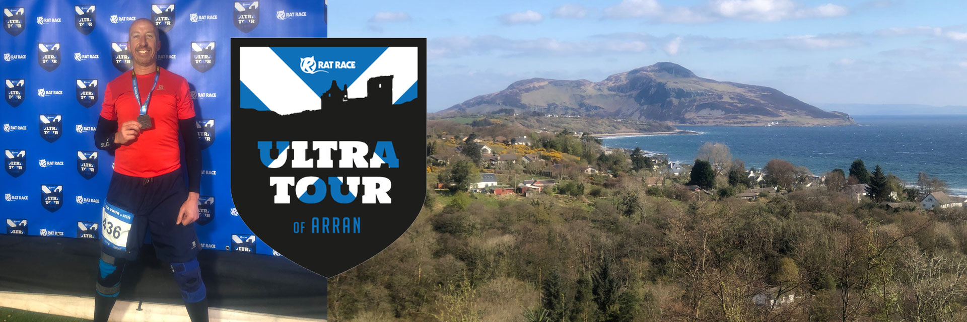
Rat Race’s Ultra Tour of Arran
OMRM race team member Mark Avery’s report on the 2019 Ultra Tour of Arran.
Arran. A word that didn’t mean much to me until a friend convinced me that trying our first ultra would be a good idea, and not just any ultra but Rat Race’s Ultra Tour of Arran to be precise. I stupidly agreed, after all we have the Rat Race season pass so why not, and once we were committed I started doing a little more research and slowly but surely that sinking feeling started setting in!
Not only is this a two-day event with an ultra-marathon each day (28 miles on day one and 30+ miles on day two) but it also combines some serious elevation, I’ve done both Man v Mountain and Man v Coast previously, but when I read up that the total over the two days at Arran was over double what I’d experienced at MvM I really panicked. Training started in earnest, slogging around a local hill route repeatedly, which helped us build not only the distance but also the all-important elevation.
Unlike many runners who drove to Ardrossan (the ferry point to Arran from the Scottish mainland) we decided to fly up to Glasgow and get the train and then the “foot” ferry option, either worked equally well but we just didn’t personally fancy an eight hour or more drive both before and after the race. The first thing that struck us as we crossed the sea on the sunny Friday afternoon was just how quickly those mountains on Arran came looming in to view, panic time!
The Rat Race set up on the island was excellent, if you’ve ever done an RR event previously you’ll know what to expect. There was a large registration tent, which once reg is over with coverts to an eating/drinking marquee with about three different food stalls and a full bar. Next to the tent was the RR official camp site (which we weren’t using, camping in Scotland in April, even we’re not that mad) and this was from all accounts well organised (located on a football field) with changing room type shower blocks nearby along with plenty of the obligatory portaloos. Registration was swift (especially given the fact we’d forgotten to sign up for the event, don’t ask, as that’s a whole other story!) and within minutes we headed for our B&B to rest up and get ready for day one.
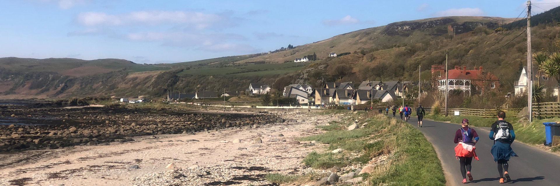
Day 1, the route meanders through the Southern part of Arran... up over a few hills and then basically follows the coast all the way down to the most southerly part of the island. The trails were a mixture of footpaths, rocky (and quite slippery) beaches as well as some sections of boardwalks, and road/pavements as we went through the small villages around the coastline. The views were stunning, helped massively by the bright sunshine and thankfully temperatures that were warm yet comfortable. There were three check points on day one, the first was around nine miles, the second around sixteen and the third and final one around 23, each of these was well stocked with water, hot tea (but you needed to carry your own cup), crisps, snack bars, biscuits, sandwiches and sweets. The rest stops certainly helped break the distance in to manageable “chunks” and although we were carrying our own food and water etc. they also really helped give you a quick break, a boost of energy and the chance to share a bit of chat with other runners. Equally if you prefer a quicker pack and are used to longer distance races then it was easy enough to keep going and pass by any/all of the rest stops.
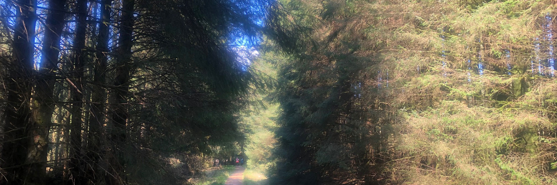
After the second rest stop we headed back inland. The route starts by taking you uphill (not so pleasant after 16 or so miles) and in to the dense pine forests that cover large sections of the southern part of the island. The trails were again hard packed footpaths etc. meaning we could keep up a reasonable pace, in one part of the forest you come upon the infamous bog, I’d heard about this from folks who had run Arran the year before and suffice to say it didn’t disappoint. A mixture of boggy marsh with a few areas of deep peaty mud thrown in for good measure, both of which helped sap the legs of their remaining energy.
After clearing the bog there were a few more miles of trails until rest stop three and from there it was pretty much a gentle run, again down well-defined trails, to the finish at Broddick. In total I clocked day 1 as just over 28 miles and 4,200 feet of elevation.
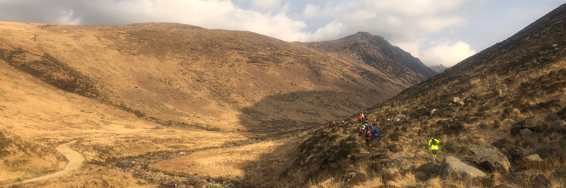
Day 2 was a slightly earlier start (7.30am as opposed to the 8.30am on day 1)... and this time we were heading to the Northern part of the island. Heading out of Broddick the route takes you straight up a valley in to the hilly/mountainous terrain. The weather wasn’t as good on day 2 and we’d been warned to take extra clothing due to the forecast high winds up on top of the mountains/fells (it turned out to be 60-70mph gusts!). We’d prepared ourselves for a tougher day and we weren’t wrong, the first few miles are a gentle run up a winding valley path and as you leave the greenery of Broddick behind the landscape changes quite dramatically (my running buddy described it as looking like Mordor from Lord of the Rings!) and becomes much more brown and barren, and then suddenly the “peaks” appear in front of you.
The first mountain/fell we headed up stopped everyone in their tracks, apart from the fittest folks right at the front, and we all went from running to hiking. Once atop this peak the views were amazing and just about everyone was taking photos rather than running straight on. From here we proceeded to run around a ridge line with views inland on one side and out to sea on the other, the ridge took us up higher again, and to another peak (which still had a little snow on top) and then from here we dropped down the back of the mountain/fell and followed another quite marshy valley route until finally appearing back in civilisation at the distillery in Lochranza, right on the North of the island and where the first rest stop was located.
As with the day before we had a quick drink, some food, and a bit of chat before heading off again, this time along a road for a mile or two until we hit the Northern coastal path, a jog along here let’s you view boats, a castle, and if you’re lucky enough (as we were) some seals. The toughest part of the entire run for me came next, a seven to eight mile slog in a very strong headwind along the coastal path heading back south, weirdly anywhere else you’d say the scenery was beautiful but when compared to the mountain we had just climbed or the beaches and forests of the previous day this part was a bit of a let-down, possibly compounded by tired legs and that annoying headwind!
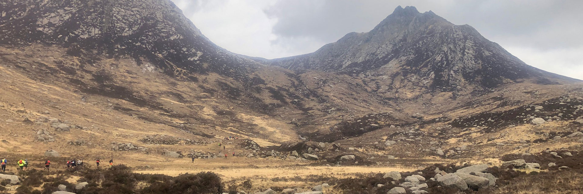
After what seemed like an age we hit the second and final checkpoint on day two, at around the 20-mile mark, from here it was a gentle run through some woodland, a shallow river crossing (no more than shin deep) and then we started to head up another winding valley towards Goat Fell (the tallest mountain/fell on the island). Once again, the terrain started to get rockier the higher we got, and it wasn’t long before even the hiking poles were abandoned, and we found ourselves using our hands and feet to literally scramble and climb through, and over, the rocky outcrops.
Eventually we arrived and what seemed to be a small plateau atop the peak, which stupidly we thought was Goat Fell, where a couple of marshals were positioned. At this point there were two choices, the high route or the low route, being no doubt delirious by this point we stupidly opted for the high route! More scrambling followed and after a few hair-raising moments we popped out higher up, again thinking we were at the summit. A marshal kindly then pointed to a ridge line which he called “The Dragons Back” beyond which we could see the actual summit of Goat Fell. The Dragons Back was a ridge with large rock piles, or spines (four or five from memory), running along it, a final push saw us get up and over these and end up atop Goat Fell with amazing views in every direction. After a few photos (and a bit of emotion), it was time to make the final run home. From the summit Broddick was clearly visible and it was simply a case of running/limping the final two to three miles back to the finish, descending first through the barren and rocky ground of the fell which quickly turned in to woodland and then finally the green and well-kept Broddick golf course. As we crossed the finish line we were elated to have completed our largest distance ever with day 2 coming in just under 32 miles with over 7,200 feet of elevation!
If you were to ask me did I enjoy Arran the answer would be a resounding yes... likewise if you ask me would I do it again then I’d say yes, hesitantly. It’s an extremely well organised (as usual with Rat Race) event and one which has the most stunning scenery of any race I’ve ever attempted. What I would say though is don’t underestimate it! Day 1 is, dare I say it, quite easy and enjoyable, if you can do a marathon distance then day 1 won’t cause you any concerns or issues. Day 2 on the other hand lulls you in to a false sense of security off the back of day 1, it’s easily achievable but my advice would be hill running and more hill running, oh and consider taking some poles (aka cheat sticks) as they come in very handy on some of those steep rocky paths up and down the fells!